
Lifestyle on Hawaiʻi Island · Community guide
North Hilo:
Rural Communities on the Windward Coast
Laupāhoehoe, Nīnole, Pāpaʻaloa, and ʻŌʻōkala — plantation history, green landscapes, and life along Hawaiʻi Island’s northeastern shore
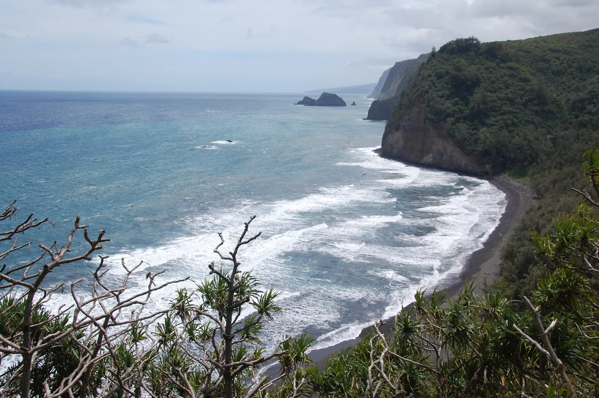
North Hilo is one of Hawaiʻi Island’s nine districts, occupying a relatively narrow stretch of the northeastern coast between Hakalau Stream and the Hāmākua district. Its communities are small, its landscapes exceptionally green, and much of its character reflects the island’s agricultural and plantation history.
Driving along Highway 19 between Hilo and Honokaʻa, the scenery is a succession of ocean views, wooded gulches, former sugarcane lands, and small settlements. Roads branch toward the coast or climb inland through pasture, agricultural properties, and forested slopes.
The district includes the communities of Pāpaʻaloa, Nīnole, Laupāhoehoe, and ʻŌʻōkala. Laupāhoehoe is the best-known, but each community has its own history and setting.
North Hilo is also part of the broader region commonly called the Hāmākua Coast. Although that name is frequently used for the scenic coastline north of Hilo, the Hāmākua district itself begins farther north. This distinction matters when searching for property, interpreting real estate listings, or learning about the island’s geography.
Communities and Everyday Life
Laupāhoehoe
Laupāhoehoe is the district’s principal community and the location of many of its public services. It has a post office, library, community swimming pool, health clinic, and a public charter school serving kindergarten through grade 12.
The present village sits above the coast, while the original settlement occupied the low peninsula now known as Laupāhoehoe Point. That difference in elevation is central to the town’s history.
Today, Laupāhoehoe Point Beach Park is a scenic place to picnic, fish, and appreciate the dramatic coastline. The park has sweeping views of the ocean and surrounding cliffs, along with a memorial to the lives lost in the 1946 tsunami. The shoreline is rocky and exposed to powerful surf; this is a place to enjoy the ocean from land, not a conventional swimming beach.
The nearby Laupāhoehoe Train Museum preserves another important part of the community’s past, when rail service connected the plantation settlements along this coast.
Pāpaʻaloa and Nīnole
South of Laupāhoehoe, Pāpaʻaloa and Nīnole are smaller communities surrounded by green agricultural landscapes, scattered residences, and deep stream gulches.
Pāpaʻaloa’s country store and café provides a local gathering place and a convenient stop along Highway 19. Nīnole is more dispersed, with rural homes and agricultural properties extending away from the highway.
These communities retain much of the character of the former plantation coast, where small settlements developed around agricultural operations rather than a conventional town center.
ʻŌʻōkala
At the northern end of North Hilo, ʻŌʻōkala is another former plantation community. Its rural setting includes residential neighborhoods, agricultural land, and views toward the ocean.
Continuing north on Highway 19 brings travelers into the Hāmākua district, with Paʻauilo and Honokaʻa farther along the route.
Landscape, Climate, and Changing Elevations
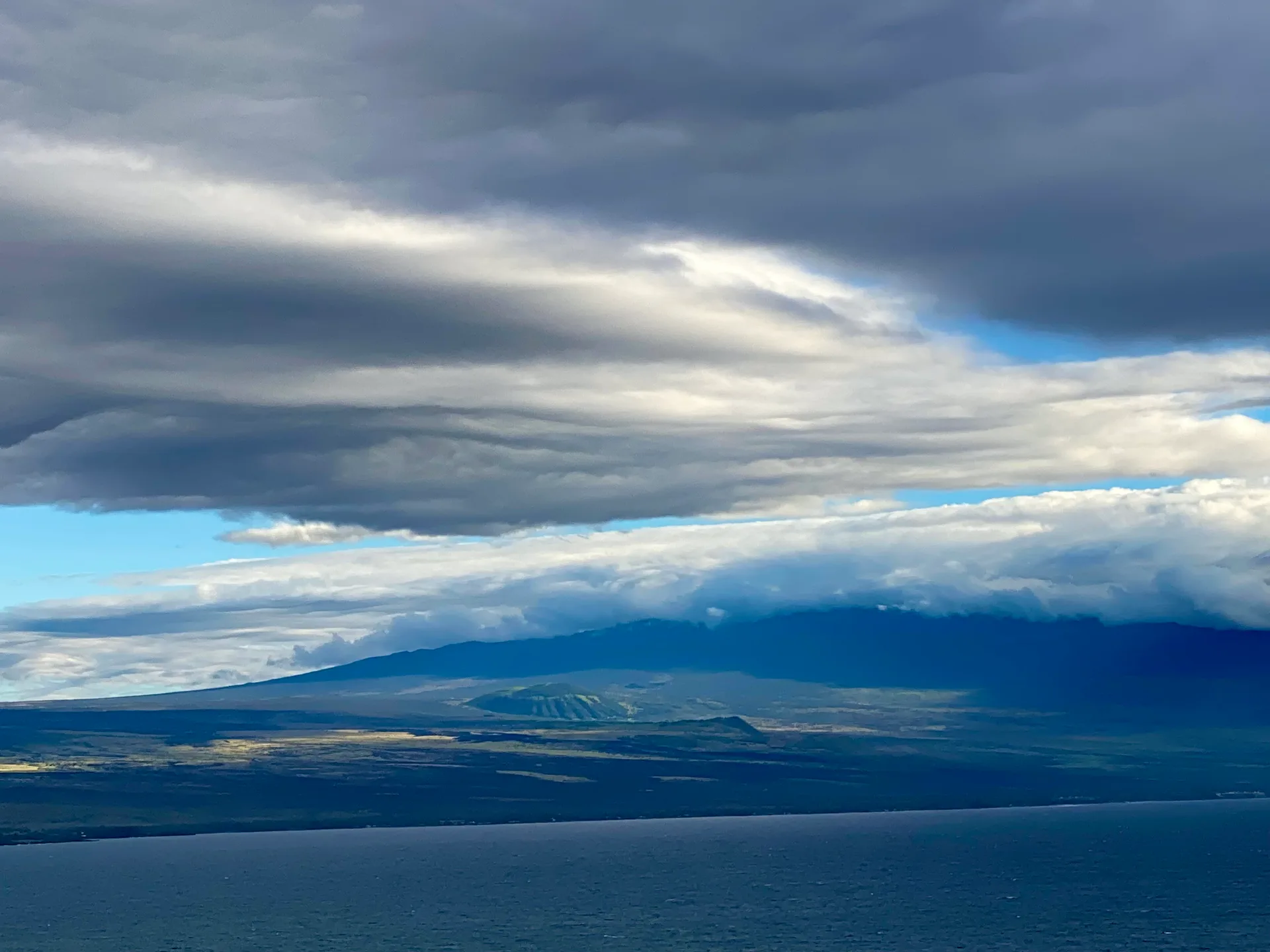
North Hilo is among the greener parts of Hawaiʻi Island. Moist trade winds, substantial rainfall, and the slopes of Mauna Kea contribute to a landscape of dense vegetation, streams, waterfalls, and agricultural land.
Rainfall varies with elevation and location, but the coastal communities commonly receive more than 100 inches annually. Conditions can be noticeably different farther inland.
The coastline is characterized by high sea cliffs interrupted by gulches and stream valleys. These natural features have shaped the area’s roads, settlements, and land use for generations.
For someone accustomed to the dry Kohala Coast, North Hilo presents a very different environment. Gardens can be lush, the air is often cool and moist, and the surrounding countryside remains green throughout much of the year.
That abundance of moisture also creates practical considerations for homeowners. Roofs, exterior finishes, drainage systems, vegetation, and interior humidity all require attention. Properties near gulches or streams warrant particular evaluation for erosion, runoff, and flooding.
The differences between coastal and mauka properties can be substantial. Elevation, rainfall, access, and the surrounding vegetation are all worth considering when comparing homes or acreage.
From Sugar Plantations to Rural Communities
Like much of the northeastern side of Hawaiʻi Island, North Hilo’s modern history is closely connected to the sugar industry.
The Laupāhoehoe Sugar Company was established in the nineteenth century, and plantations eventually occupied large areas of the district. Sugarcane fields extended inland from the coast, while mills, plantation camps, and small commercial centers supported the agricultural workforce.
Transporting sugar and supplies across the steep terrain presented considerable engineering challenges.
The Hawaiʻi Consolidated Railway, developed in the early twentieth century, connected Hilo with plantation communities farther north. Its route required bridges, trestles, and tunnels to cross the numerous gulches. The railway carried passengers as well as agricultural freight, becoming an important link between otherwise relatively isolated communities.
The 1946 tsunami destroyed significant portions of the railway, which was never rebuilt. Sections of its former route were subsequently incorporated into the highway system.
The Laupāhoehoe Train Museum offers a closer look at this period through historic photographs, artifacts, and exhibits.
As sugar production declined and ultimately ended along this coast, former plantation lands transitioned to other uses, including forestry, diversified agriculture, grazing, and residential properties.
The plantation era remains visible in community layouts, older buildings, road alignments, and the names of settlements and former camps.
The 1946 Tsunami and the Rebuilding of Laupāhoehoe
On April 1, 1946, a powerful earthquake in the Aleutian Islands generated a tsunami that devastated communities along Hawaiʻi Island’s eastern coast.
Laupāhoehoe Point was particularly vulnerable because its school and homes stood on a low peninsula surrounded by the ocean.
Twenty-four people, including students and teachers, lost their lives at Laupāhoehoe. The disaster remains one of the most consequential events in the community’s history.
Following the tsunami, the school and much of the community were relocated to higher ground. The new school campus opened in 1952.
There is also an interesting architectural connection: the new campus was designed by Alfred Preis, the architect who later designed the USS Arizona Memorial at Pearl Harbor. Its construction marked an important chapter in the community’s recovery.
Visitors to Laupāhoehoe Point today will find a memorial honoring those who died. The location provides a powerful reminder of the relationship between Hawaiʻi’s coastal communities and the natural forces that shape the islands.
Places to Explore
North Hilo is not a major resort or visitor destination, but there are worthwhile stops for people interested in local history, landscapes, and the quieter parts of Hawaiʻi Island.
Laupāhoehoe Point Beach Park offers dramatic ocean views, picnic areas, and the 1946 tsunami memorial. It is one of the district’s most distinctive coastal settings.
Laupāhoehoe Train Museum preserves the story of the railway and the plantation communities it served.
Pāpaʻaloa Country Store and Café is a convenient stop for refreshments and a glimpse of everyday life in a small rural community.
The district also has upland natural areas and forest lands, although access, trails, and permitted activities should be checked before visiting.
Nearby Attractions Along the Hāmākua Coast
Several of the best-known attractions associated with the Hāmākua Coast are actually south of North Hilo, in South Hilo district.
ʻAkaka Falls State Park, near Honomū, features a 442-foot waterfall surrounded by tropical vegetation. The Hawaiʻi Tropical Botanical Garden at Onomea Bay is another remarkable destination, reached by the scenic Old Māmalahoa Highway.
These places are convenient additions to a drive through North Hilo, even though they lie outside its district boundaries.
Living in North Hilo
For prospective homebuyers, North Hilo offers an alternative to Hawaiʻi Island’s larger towns and resort communities.
Properties may include older plantation-era residences, modest homes in established neighborhoods, rural houses on larger lots, and agricultural acreage. Some enjoy ocean views; others are surrounded by gardens, pasture, or forest.
The appeal is the landscape and rural setting, along with the opportunity to live in a small community away from the island’s busier residential and visitor centers.
The trade-offs deserve equal consideration.
Services and Transportation
Laupāhoehoe provides basic community services, but residents generally travel to Hilo or Honokaʻa for a wider selection of shopping, professional services, and medical care.
Hilo is approximately a half-hour drive from Laupāhoehoe under favorable conditions, depending on the destination. Travel times vary with weather, roadwork, and traffic.
Highway 19 is the principal connection along the coast. For anyone commuting regularly, the route and travel time should be part of the property evaluation.
Water, Wastewater, and Utilities
Infrastructure varies by location and property.
Some homes have county water service, while others may depend on private water systems or rainwater catchment. Wastewater disposal may involve a cesspool or septic system rather than a municipal sewer connection.
Buyers should verify the water source, its capacity and reliability, the condition and permitting of the wastewater system, and any applicable requirements for future upgrades or conversion.
Electricity and internet service also need to be confirmed at the individual address. A property that appears close to existing infrastructure may still require significant work or expense to obtain a new connection.
For buyers who work remotely, actual internet availability, speed, and reliability are especially important.
Agricultural Land and Property Access
Larger parcels can be attractive for gardening, orchards, small-scale agriculture, or simply additional space and privacy.
However, acreage introduces questions that may not arise with a conventional residential lot.
State land-use classification and county zoning determine what uses are permitted. Agricultural zoning does not automatically authorize every type of residential or commercial activity, and existing structures or improvements should be checked for permits.
Legal and practical access are equally important. Private roads, shared driveways, recorded easements, maintenance agreements, and the condition of bridges or stream crossings can materially affect a property’s use and value.
On steep or heavily vegetated land, a survey and careful inspection of boundaries, slopes, drainage, and usable acreage may be particularly worthwhile.
Natural Hazards and Property Maintenance
North Hilo lies on the older volcanic slopes of Mauna Kea, where lava-flow hazard classifications are generally more favorable than in the island’s most volcanically active districts. Laupāhoehoe is commonly identified within Lava Zone 8, but the classification should be confirmed for each parcel.
Flooding, drainage, erosion, and coastal hazards may be more immediate concerns.
For properties near streams or gulches, buyers should review flood information and investigate the condition and stability of the land . Coastal properties warrant additional attention to shoreline conditions and tsunami evacuation zones.
High rainfall also affects the practical cost of ownership. Exterior maintenance, vegetation management, moisture control, and road upkeep can be important recurring expenses.
These considerations do not make North Hilo unsuitable for homeownership. They are simply part of understanding the property and its environment before making a purchase.
Is North Hilo Right for You?
North Hilo will appeal to buyers who appreciate green landscapes, rural communities, agricultural surroundings, and the natural beauty of Hawaiʻi Island’s windward coast.
It may be less suitable for someone who wants a short commute, extensive nearby shopping, resort amenities, or consistently dry weather.
The best way to evaluate the area is to spend time in its different communities, visit properties at more than one time of day, and experience the roads and surroundings in both sunny and rainy conditions.
As with any part of Hawaiʻi Island, the specific property matters as much as the district. Two homes only a few miles apart may differ significantly in rainfall, elevation, access, utilities, and maintenance requirements.
North Hilo offers a distinctive way of life, shaped by its landscape, history, and small communities. Understanding those characteristics is the starting point for deciding whether it is the right place to call home.
If you are weighing North Hilo against other districts, the Moving to Hawaiʻi Island guide compares where to live across the island.
With aloha,
Carol Porter
REALTOR® · RS-87584
Better Homes and Gardens Real Estate Island Lifestyle